Tours
Flights
Lodges
Guides
Transport
Blog
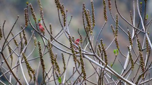
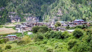
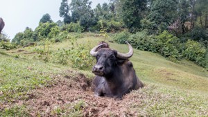
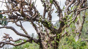
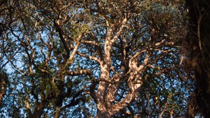
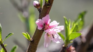
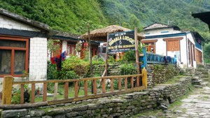
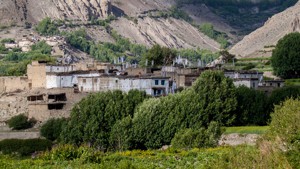
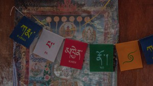
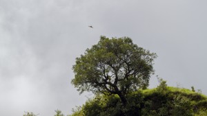
Simalchaur literally means the Field of the Silk Cotton tree. The Silk Cotton Tree (Bombax ceiba) is a deciduous tropic
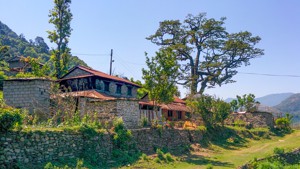
Khudi is a hodgepodge affair of a town/village which has lost enough culture to be called 'traditional' and hasn't yet
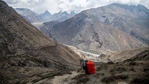
(NOTE: No Accommodation Facility. Bring your own Tent.) Kuchumro Phedi or Kuchumro High Camp is the camping site when c
(NOTE: No Accommodation Facility. Bring your own Tent.) Namge Phedi is a place where you realize that your day isn't do
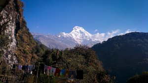
(NOTE: No Accommodation Facility. Bring your own Tent.) At Yarcha pass, you will be rewarded with fantastic views of Ka
Karte is a little but very homely village which rather than being important in its own right is important because of wh
Meta is the winter home for the people from Naar and offers only basic of amenities if any. If you are planning to stay
Kyang is a winter settlement for the villagers from Phu and has impressive views of Pisang Peak, and Annapurna II.
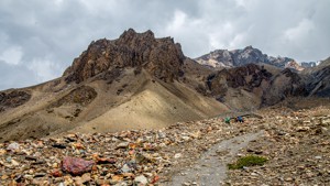
(NOTE: No Accommodation Facility. Bring your own Tent.) Phu Pass has beautiful views of Himlung Himal and Kanguru Himal
(NOTE: No Accommodation Facility. Bring your own Tent.)
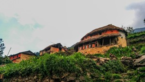
Tache is a pretty large Gurung village of about 60 odd households. As with most villages in Nepal, in addition to the d
Pisang is pronounced 'P-shaang', not 'Pi Sang' because numbers don't sing. Anyways, between the two Pisangs, this is th
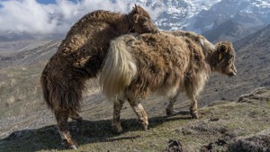
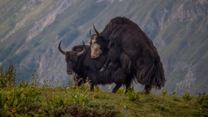
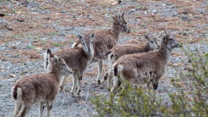
Naar gets its name from Naaur, the Nepali name for Blue Sheep. And indeed chances are you will see a lot of them here.
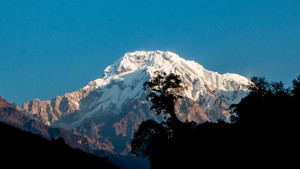
ABC is another base camp that is no longer used by mountaineers as a base camp. The current location however was used i
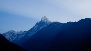
Machhapuchhre Base Camp (MBC) has the distinction of being the base camp for a mountain that can't be climbed. Most peo
Nache is a small Gurung village which can be reached from Tal in around 2 hours. This village not only offers a beautif
Gharap is a small settlement that has one small eatery. But the thing on your mind when you get here is not Gharap but
(NOTE: No Accommodation Facility. Bring your own Tent.) Checkhu is nothing more than a few yak enclosures. But when tho
To sum it all up Jomsom is the most advanced of all the villages and towns in the Annapurna Circuit and the largest too
Dhumba is a small streamside settlement at the foot of the Kutsapterenga Monastery. There is very little in his settlem
(NOTE: No Accommodation Facility. Bring your own Tent.) Shongle is the campsite for the night if you are coming from Ta
(NOTE: No Accommodation Facility. Bring your own Tent.) The first of the high passes along the Annapurna Seven Passes T
(NOTE: No Accommodation Facility. Bring your own Tent.) Namkyu offers impressive views of Lamjung Himal, Annapurna II a
(NOTE: No Accommodation Facility. Bring your own Tent.) At Meta Pass, you are entering into one of the most remote plac
Chyakhu is another winter settlement in the region.
Phu is a village that takes you back in time. From a distance, it looks as though it has been carved out from the hills
(NOTE: No Accommodation Facility. Bring your own Tent.) Loang is an excellent place for camping, and can comfortably ac
(NOTE: No Accommodation Facility. Bring your own Tent.) The top of the Kangla Pass probably offers some of the best 360
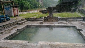
Tatopani!! Oh, Tatopani!!! This village or more like a town now has built a legend around its hot water spring. And it
Badalbisauna which literally translates to 'rest stop for clouds' will perhaps be little more to you that just that. So
Bahundanda is the last Indo-Aryan village before the Tibeto-Burman strongholds of the north. And also rather than the w
Chyamche in Nepali quite literally means….well, not everything has got a literal meaning in Nepali so get over it. But
The Khanigaon that you see along the trail with one little lodge is actually just a tiny spillover from a large village
Jagat means 'toll station'. This was once the site of a tax collection post for the Tibetan salt trade through the Mars
If you thought the previous few villages were small consider this one invisible. With just a handful of houses here, it
Lili Bhir is a little more than a two lodge affair next to a shady ravine. And while the village is rather unremarkable
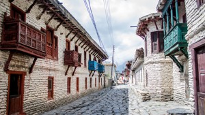
This Bhotiya settlement can be easily identified and the Tibetan influences are obvious with flat-roofed stone houses.
Danakyu emerged as an important village after the landslide disasters in Bagarchhap, as many villagers and lodges shift
Comparatively speaking Thanchok is larger than the previous village of Kurung, but then Kurung is really small. Thancho
Julu is basically a few houses on the alluvial plain carved by the Julu Khola as it closes in on the mighty Marshyangdi
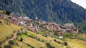
We personally find Kalaghiring the most picturesque village along the homestay route. However, the village is yet to ca
Siurung is an old Gurung settlement with a view that is unchallenged. The thing with large settlements so high up in th
Mugje is the meeting place for the higher and lower route that starts just after Dhikur Pokhari. It is a small settleme
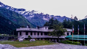
Manang is famous amongst the trekkers specifically because of the well-stocked shops, good gear shops, health posts etc
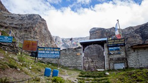
Reaching Thorung High camp is quite an achievement in itself so don't belittle yourself too much if somehow you feel si
Not many people seem to know the name Ranipauwa as through the years people have referred to this place by the name of
Location in deep forest, Bhaisi Kharka is basically a two lodge affair fit for tea or lunch.
Sildhunga is a small Gurung village not very different from the other villages along this homestay trail. However, you
Himalpani also known as Himalkyu is a one lodge affair with a small hydro- powered Ghatta just before the lodge. More l
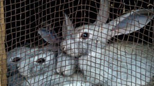
Will Hunting: How do you like them apples? HoneyGuide: Apples, Apple ciders, Apple brandy, Apple juice, Dried apples,
Humde is probably most famous for its airport as it is the only one in the Marshyangdi valley of the Annapurna circuit.
Kimrong Danda is a small ridgetop shettlement with a couple of homely lodges. While Kimrong Danda provides commanding v
Besisahar literally translates to "the town at the base of a hill" and is the district headquarters of Lamjung district
The place is called Sattale which literally means 'seven storeys' because traversing the rock formation there would in
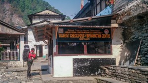
Birethanti is where you enter Annapurna Conservation Area. So you will need to register at the ACAP office just across
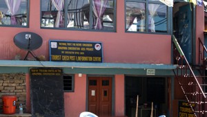
Pothana is a small village that sprang up around the ACAP Tourist Checkpost. You will need to present your ACAP and TIM
Hile is basically an alternative stop to Tikhedhunga for camping groups, claustrophobes and hydrophobes. The name 'Hile
Phedi which literally means 'foot of a hill' in Nepali is the roadhead for the steep climb to Dhampus. There are a coup
Kagbeni is as far north a non-Nepali with an ACAP permit can go. Beyond Kagbeni requires a special permit for Upper Mus
Dhampus is a favored quick getaway for locals and tourists from Pokhara and for good reason. This Gurung village has ex
Bheri Kharka is where your trail will meet the dirt road to Landruk and after that steep descent you might even enjoy w
Tolka is a small village in which almost every other house is a lodge.
There are actually two individual places that are called Sinuwa. People walking from Chhomrong usually have lunch at th
Kande is the roadhead for Australian Camp which is about 2 hrs climb. So get a quick bite, fill up your bottles and off
Dhampu is hardly a village and you will probably not even notice this little village as you make you way past the slate
Chhomrong is in the nerve centre of the upper reaches of the Annapurna Sanctuary. Most of the lodges in the Annapurna S
Tilche is little more than a tea stop and will be a welcome one after the labors of uphill.
Samrung is a rather rustic village and is where the trail coming from Ghandruk meets the trail coming from the river. A
About one and a half hours from Dobhan is a small shrine dedicated to Paunchhi Barah and taking meat especially pork be
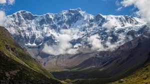
Himalaya is a basic two lodge affair. However, here you will be entering avalanche prone area. While the chances of see
After the claustrophobic narrows, it will feel like you can finally breathe again. While getting past the tree line has
Kimrong Danda is a small ridgetop settlement with a couple of homely lodges. While Kimrong Danda provides commanding vi
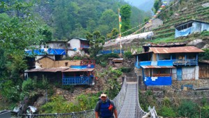
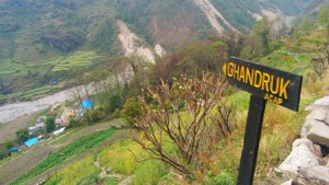
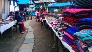
At Ghandruk, you are in the capital of the Gurungs and you will even get to dress like one here. But more on that later
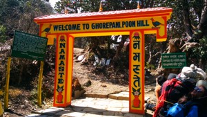
Ghorepani or more properly Ghodepani, means watering place for horses in Nepali. Back in the days, the route from Biret
Gyaru or as the locals like to call it "Yak-Ru" lies on the higher route. The higher route, as opposed to the lower rou
Banthanti is a small collection of lodges wedged between the walls carved by the stream nearby. Along the trail that fl
Long before Tibet came under the power of China and the import of sea salt from India, Tibet would be the major source
Deurali, which means ridge in Nepali, is a small ridgetop lunch stop. However, there are two clusters of lodges here an
This kilometer long serpentine village was built recently to cater to visitors. Before, it was just 'Banthanti', a rest
Yes those crazy steps are now behind you!! Reward yourself with some refreshments and enjoy your first view of the loft
Nayapul which literally means "New Bridge" is where the hustle of a national highway outshines the tranquility of natur
Chuile is a small village with basic lodges and is basically a speedbreaker to slow down your descent to the Kimrong st
Australian Camp is one of the best kept secrets of the area. For expansive mountain views, it as good as if not better
Gurjung with its homely lodges is a perfect place for lunch if you are on your way to Chhomrong. It also has the distin
Siran Tal is simply an offshoot of Tal and being located to the north or so to speak at the head is called Siran (head)
Landruk is the smaller and somewhat plainer sister of Ghandruk. It is nevertheless a large Gurung village with decent a
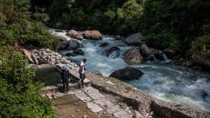
With the sunshine and the steady hum of Modi River beneath, New Bridge is the perfect place to appreciate the contours
The name Phedi in Nepali means 'base of a hill'. It is a two lodge affair. Thorung base camp is the larger lodge and Ho
Jhinu Danda is a small ridgetop settlement that is famous for its hot springs. If you are in the mood for a dip, the ho
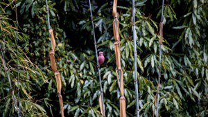
The cane bamboo that starts to appear around New Bridge becomes such an unmistakable feature round here that the place
Tikhedhunga, which means sharp stones in Nepali, is located right beside the Bhurungdi stream amidst the cool shade of
If you skipped on lunch at Banthanti, Nangethati is the perfect place to have lunch. Wonderfully set, with forests on a
Located on the northern bank of a small tributary of the Modi Khola, there are a couple of small eateries here. Whether
Tadhapani which literally means 'Far Water' in Nepali got its name as the water source was once a long distance from th
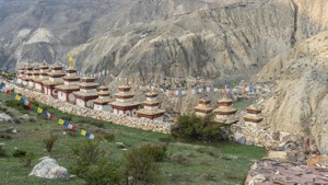
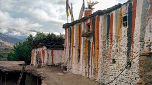
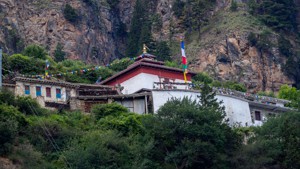
Also spelled Dzong, this village is historically important primarily because of the fort that used to stand here on the
The name of this place is said to be inspired by the sound of gurgling water in a nearby water source. While there is a
Shri Chaur is a small village in which almost every other house is a lodge. You will enter and exit the village like Ji
Qunche is a very small village with two lodges. If you are walking at a frantic pace you probably won't even realize th
Pairothapla is the last village in Mustang district. You will soon be entering Myagdi district which is mostly populate
Ghermu is a rarity. What might seem like a small patch of flat land is actually as large as the Great Plains would be i
Dharapani is the first village in the circuit with an ACAP and police check post, so get ready with your permits. Besid
At Timang you will feel the sudden increase in altitude. The approximate difference between Timang and Danakyu is 400 m
Khingar is just a small village to the west of Jharkot with nothing much of interest other than a settlement mound wher
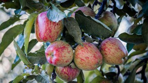
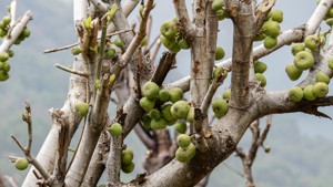
Bhratang is characterized by large apple orchards. Although nowhere near to Marpha's orchards in scale, Bhratang can be
Talekhu is a small settlement with large fields of wheat, barley, and buckwheat surrounding it on all sides. Not many p
For the district of Manang, Chame is an important town as it is the district headquarter. It is also important to trek
Kalopani literally means 'black water' in Nepali. It is from here that the relatively calm Kali Gandaki river narrows d
Ngawal/ Nawal is one of the oldest and the largest villages in the Nyeshyang region. Along with Manang and Bhraka, Ngaw
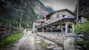
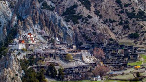
The settlement of Bhraka or Braga (originally spelled and pronounced as Braga) can be seen on a slightly elevated land
With just two lodges Ghusang (also spelled Gunsang) is a small village. The settlement is towards the south from the tr
Kharka in Nepali means alpine pasture. Yaks used to graze in these lands and so the locals started identifying this pla
Khangsar, or as is traditionally called Ngaba, is one of the older villages in the region and it sure has the charm to
Another one of the Paachgaon (Paach=five, gaon=village) which also has some apple orchards but isn't particularly famou
Samle is a small village right next to Dhumba Lake and one of the houses there will be able to help you if you find tha
This isn't a separate settlement but rather a Tibetan camp, Duh! It is just an extension of Chhairo village. Surrounded
The name is Larjung probably because it's larger than the other two nearby villages of Khanti and Kobang. Bad joke, we
Syang is a quaint little village that will require a little climb away from the road. There are two tiers of settlemt i
For the mountain views, Naurikot couldn't have been positioned any better. To the west is the towering Dhaulagiri along
Lete is just an extension of Kalopani and there are only a few houses here. There is a police check post here where non
Kobang along with Khanti and Larjung is considered the cultural center of Thakalis. The Thakali people believe their an
The 'thanti' at the end of this village signifies that you have now left the cultural sphere of the Thakalis of lower M
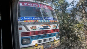
Many trekkers end their Annapurna circuit trek at Ghasa because there is a bus stop here. There are buses and jeeps ava
Gadpar is a small village with the more important village of Dana on the other side. If it is getting late and there is
Dana used to be an old customs point during the days of the salt trade. Merchants would bring salt from the Tibetan lak
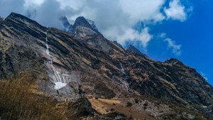
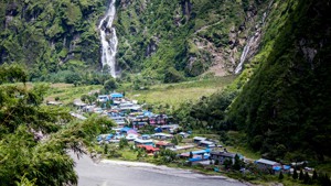
The first thing that you notice as you finish that climb onto Narchyang is the waterfall. The size of that thing is ama
Mipra is another Gurung homestay village with about five houses having gotten on the homestay bandwagon. And just like
Truth be said, Chokhopani is little more than a one house affair and we would not even have mentioned or marked this pl
Dhagai marks the end of what must have seemed like an endless climb from Khudi. However, there is not much here and sin
Quietly tucked in a side valley where few travelers go, this village is a gem. It also happens to be one of the few rem
This place is named after a pond to the west of the lodge settlement which goes by the name Dhikur Pokhari. Dhikur or D
Patar is T minus 2. But as you cross that suspension bridge to climb up to the village of Narchyang, be ready for a sma
Syange is a tiny village with a handful of lodges on both sides of the road. The Syange waterfall is huge and makes its
You can easily miss this little village of Kurung and we don't blame you. This little village comes just before the dro
Putak is more like a crude collection of houses to look after the fields rather than a true village. As you enter this
It is a small village amidst large cultivation lands. But the colorful houses give a certain character to the village w
Consider Upper Pisang the elder brother of Lower Pisang. The height difference between them is a mere 100m. Surrounded
The small settlement of Ledar comes immediately after crossing a long suspension bridge. It is not a single cluster of
The original name of this place is Kak Nyingba (Kak means "block") but nowadays is more commonly known as Eklebhatti wh
Khanti, Kobang, and Larjung are so close to each other that travellers fail to realize that these are separate villages
Locals relate that about 200 years ago the place where the current village is, used to be a small lake which gave the v
Koto is a pretty important village as it sits on the confluence of Marshyangdi and Nar rivers. If you take the trail to
Ngadi is a Gurung settlement inhabited by people from older villages higher up the slopes. Since this part of the area
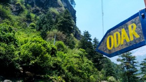
Odar is a quaint little village that is getting very popular for its amazingly serene location and well run homestays.
Thini is perhaps the most important village in the lower part of Mustang in terms of culture. It is part of what is cal
Kopchepani is a small rustic Magar village with one lodge that might close anytime. Also at the southern end of the vil
Chhapdanda village has an active homestay community. It is another quintessential Gurung village with slate roofed hou
(NOTE: No Accommodation Facility. Bring your own Tent.) At Naar Pass, you are greeted with a 360 view of the mountains
Also known as Bhichok Deurali or simply Deurali, Pitam Deurali is a small ridge top tea/lunch spot with basic accommoda
Jharkot, also spelled Dzarkot or simply Dzar was a powerful place back in the days. I you visit this village today then