Tours
Flights
Lodges
Guides
Transport
Blog
Toktok is basically just a couple of lodges beside a stream which is home to a micro hydro electric project and some li
While Khunde adjoins Khumjung, it is a completely separate community. It has the well equipped Khunde Hospital which ca
Junbesi is named after the moon. Specifically, Junbesi is believed to be the place where the moon (Jun) comes down belo
Located on both sides of the Dudh Koshi River, this three lodge affair is the perfect place to grab a quick bite or a c
Bengkar offers the first view of Mt. Thamserku, another local divinity. There is also a small waterfall pool here.
Zam Phute is simply an extension of Phakding village and has decent accommodation if you are looking for some quiet tim
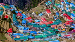
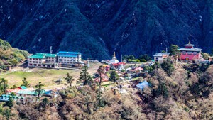
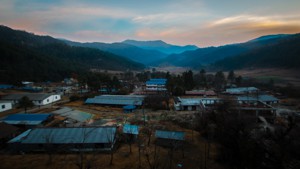
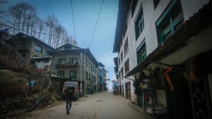
Welcome to the Heart of Khumbu. This village which is built on an ancient cirque is the largest of all Sherpa settlemen
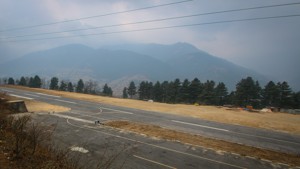
Syangboche like Lukla is another airport town. But somehow it just hasn't been able to take off. It only sees occasiona
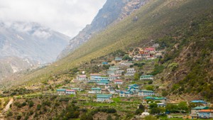
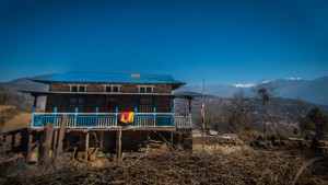
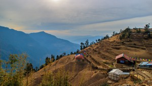
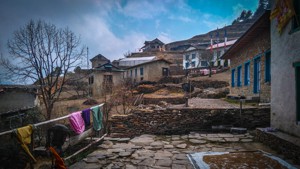
Khumjung is hands down the most beautiful village in Khumbu. This spread out village with uniformly green roofs blends
Phakding used to be the source of white micaceous clay which was used to whitewash house walls. And this is what the wo
Thukla, also known as Dughla, lies at the very end of the Khumbu glacier and is usually just a lunch stop. However, if
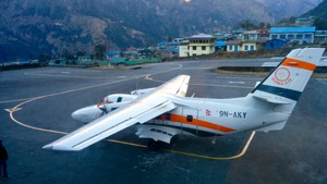
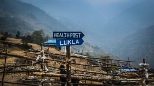
Lukla owes its present form to that great legend, Sir Edmund Hillary. The original airstrip was built in 1964 by Hillar
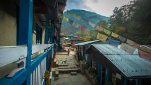
Chheplung village is the perfect model for how the trail is going to be until one enters the National Park; lodges afte
Thado Koshi means precipitous stream and as you cross the bridge built by the Kadoorie Foundation, you will see one. Th
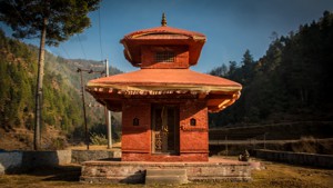
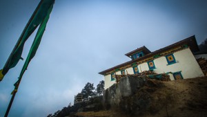
Ghat continues the endless stream of lodges. However, at the northern end of town is the privately owned Yulnging Gompa
Chumoa has a couple of lodges and a TIMS checkpost. There is also a large rock enclave along the trail that the locals
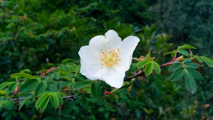
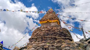
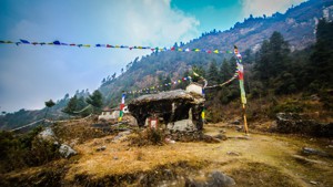
Monjo is the last village before the Sagarmatha National Park and is quite a sight during late May when there is a prof
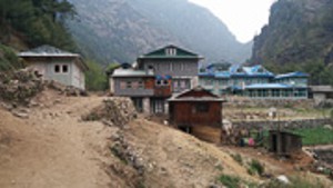
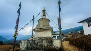
Jorsalle is the first settlement inside the National Park and the last one before Namche which is at least 2 hrs furthe
Kyangjuma is the perfect place to quietly breathe in the mountain scenery. A little beyond Kyangjuma is the meeting poi
Sanasa has a few homely lodges and many souvenir stands.
Leushyasa is basically just a few teahouses. There is also a small nursery run by the National Park here.
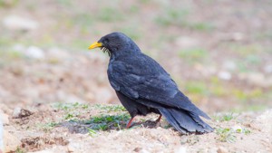
Phunki Tenga beside the Dudh Koshi River is a good spot for Himalayan Griffons which nest in cliffs further up along th
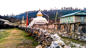
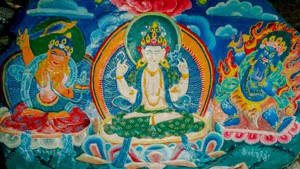
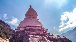
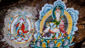
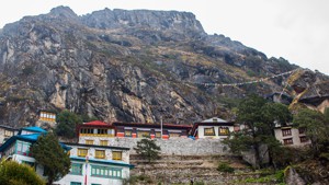
Tengboche has something of a charm about it. The famous Tengboche Gompa has a part to play in this, but the beautiful b
Like Tengboche, Deboche is a monastic settlement established by Lama Gulu for the benefit of nuns. It is also a quiet a
Lower Pangboche is simply a touristic extension of the old village of Pangboche higher up. It also used to be the upper
Syomare is the first settlement after you cross the tree line. While it is little more than a lunch stop, basic accommo
Orsho is just a one lodge affair. It is also the place where Everest is finally eclipsed by the Lhotse-Nuptse wall. Nex
Dingboche which used to be a summer settlement for yak grazing, now caters to trekkers year round. Located about 1,000m
Chukung is an important acclimatization spot for trekkers traversing through Kong Ma pass. And if you end up having a r
Pangboche is an idyllic village and its roots go back to the time of Lama Sanga Dorje, the patron saint of Khumbu. Supp
Beautifully set at the foot of Taboche, this quiet village is a gem. The valley in which Phortse is located has the hig
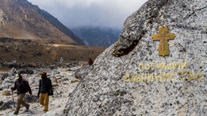
Tucked safely in a corner near the meeting point of Lobuche and Khumbu glaciers, this place offers some of the most bre
Gorakshep marks the end of lodges and will be your base camp for your trips to the Everest Base Camp and Kala Patthar.
Mong makes us wonder why all places associated with holy men are so idyllic. And this village said to be the birthplace
Placed on the bank of Bhote Koshi river, Tarnga is mostly a lunch places on the route between Thame to Lungdeng.
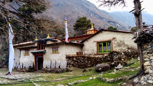
Thamo is a small village located southeast of Thame. The village is collection of old stone houses surrounding the ruin
This small Sherpa village sits beneath the mountain wall of the Kongde peak. It is home to three of the finest mountain
Dole is a small grassland just above the valley of streams. Very unlikely to how it looks, but the meaning of Dole bas
Lungden is a small tea house settlement just after/before Renjo La. Being a popular rest spot of trekkers who are heade
Located north of Dole and south of Machhermo, Luza is a great view point overlooking over 7 moutains above 6000ms; a gr
Machhermo is a small stop with few tea houses and tons of mountains. Yes, more mountains. The place is quite popular as
Lopharma falls on the route between Luza and Dole and contains a few tea houses and with views of Cholatse on the East
Thagnak is a popular rest spot after the long traverse of Cho La pass. Don’t be confused you were expecting Dragnag, it
Located above Bhote Koshi river, Samde lies between Thamu and Thame on the route to Renjo pass from Namche. Views of Sh
Tucked into the top of the ridge between Lobuche and Cho La pass, Dzongla is a small village with few teahouses. It is
This pass between Lobuche and Gokyo is locally known as ”Tso La” which literally means, the lake pass. Don’t get excite
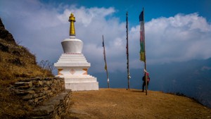
This majesty at 5417m/17772 ft is also known as Lenjo La. The pass connects Gokyo Valley with Thame region. In between
Kongma La means, “Tibetan Snowcock Pass”. At the altitude of 5535 m / 18159 ft, Kongma La is the highest amongst the th
After reaching Goyem, take alook back. You'll probably be overrun with instant relief when you look back at the path yo
When the first of the mountaineers passed through Jiri on their way to Everest, they must have acknowledged the landsca
Mali is a small village with few tea shops. Once, Mali was a popular first-day tea stop for trekkers and locals coming
Named after the temple of Shiva, the town of Shivalaya is a usual first-day rest for trekkers who started from Jiri. Th
Deurali, meaning pass in Nepali, is a very common name to hear when you are in the mountains of Nepal. Just like every
Bamti Bhandar, also known as Chyangma among the locals, sits on an elevated plain above the Likhu River. The town of Ba
Kinja is a small village of a few teahouses and construction equipments. Situated in a narrow valley where the Likhu me
Dagchha is a hope for your legs after the long ascent from Kinja. If your legs are dying to rest, you could stay here.
At 3500 meters, Lamjura La is the highest point of your trek from Jiri to Lukla and whether you are walking or flying t
Traksindo La is one of the major passes that will lead you towards the Dudhkoshi Valley. From the pass, you have a spec
Once believed to be a lake, Surke is a town built upon a fertile land and damp environment. Surke is situated on the bo
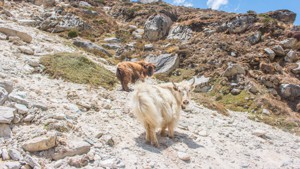
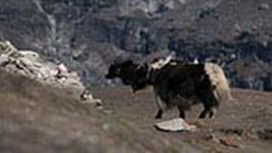
Mules, yaks, and horses make up more than half the population of the town. Being the last town in Northern Solukhumbu c
With a panoramic view of Khari la, Khari Khola and Chutok la to the valley you would have to walk for next few days ahe
After the monstrous climb ahead out of Bhupsa, Khari La is there to give you a climax of reaching the top. With a panor
Jubing is the only Rai settlement in the region after Sete. At the altitude of 2,003 meters, Jubing is a farmer's heave
Located at the foothill of Kajyo Ri and south of Lundgen, Marlung is a river side settlement. Marlung is one of the lar
After quite a climb past Jubing along a muddy trail, moon dusted by the dance of mules, you will reach Kharikhola. Past
Puiyan is a beautiful settlement of tea houses which sits on the bottom of towering hill. Puiyan is the popular overni
Chheubaas is a small village with two lodges. Though, it is not a popular stop for travelers, anyone who has stayed her
On the way towards of Chaurikharka, Mushe is a small local settlement of farmers. Most trekkers pass through this villa
ChauriKharka means grazing grassland for yaks. And the village surely is built upon humongous grasslands. Once you get
Phaplu is the town with the airport. Yes, an airport which does have a regular flight. However, unlike Lukla, Phaplu ai
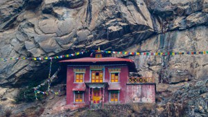
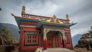
The pride of lower solu, Chiwong Chhyang - Chup Monastery is perched a cliff, above Phaplu and the village of Chiwong i
Sete sits on a side of a hill almost looking heavenly with green vegetable fields and beautiful houses. Towards the wes
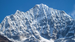
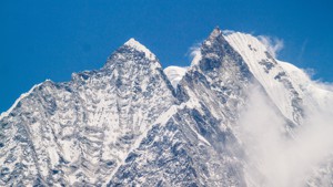
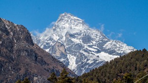
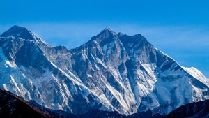
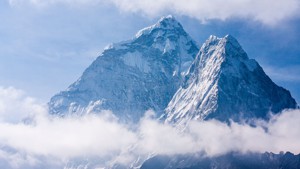
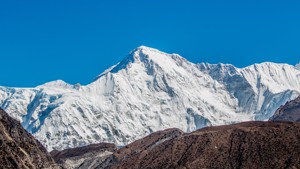
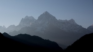
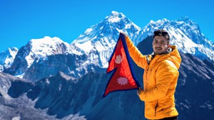
After days of walking, finally the moment has come to meet Chomolungma, the Mother Goddess of the world, also more popu
Chiwong is a small village below a towering cliff. Some restaurants have been built on the side of the road and you wil
Salleri is the administrative headquarter of the region. A melting point of different cultures and businesses, Salleri
Sallung is a small settlement one will come across on this trip. This is a logical resting spot in terms of distance, t
What is your thing? Apple, cheese, apricot, cider or mountains? Welcome to Ringmo. Here there are treats in store for t
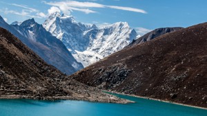
Gokyo Kharka is a lesser known name of this stop. Named after the third lake the settlement now goes by the name of Gok
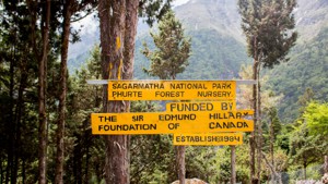
Phurte is the first settlement after Namche or lasts before depending on which way you started this journey. It is a be
Nestled in a valley sculpted by the Khumbu glacier, Pheriche used to be a summer settlement that got a facelift after t