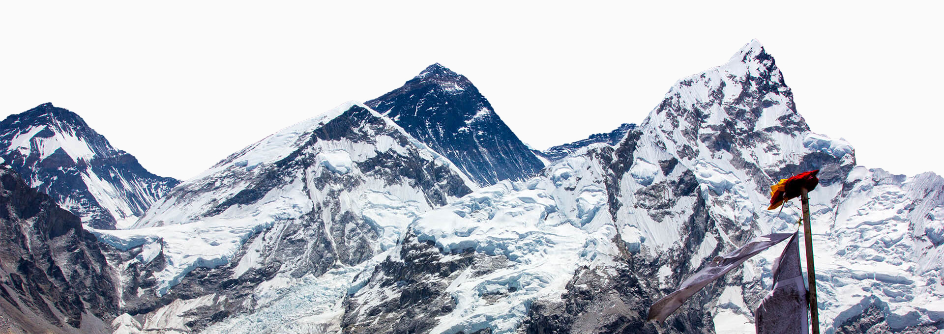
Everest Base Camp Trek isn’t exactly a ‘remote area’ now. Well, maybe in terms of transportation but that was more or less a deliberate attempt. It had to be kept that way as so people could enjoy the tranquility of nature without any disturbance. Other ‘development’ however was inevitable so that the place could cater to the 40 thousand plus visitors that come to the region annually. Due to such extensive interest in Everest, not only has a lot of infrastructures been built but also a lot of studies have been conducted. Add to that the plethora of guidebooks on the region and you would think this is an area with very little secrets. Fortunately for you, we have listed out amazing facts along Everest Base Camp Trek route that no main stream information provider will be able to deliver.
Here are 5 amazing secrets of Everest region that you have never heard of.
1. People disappearing in Pokalde
Pokalde Peak is located 12 km south-west of Mount Everest and is less than 4 km from Dingboche, a popular rest spot along the Everest Base Camp Trek. It has the distinction of being the easiest, shortest and most accessible trekking peak in the region. Despite (or perhaps because of) such a label, 10 people have disappeared in the vicinity since the 1990s. While overconfidence, especially among independent trekkers and the resulting altitude related complications, have definitely had a part to play in this, the Sherpas have put an interesting twist on this statistic. They say it has got to do with the existence of a doorway to a Beyul in the vicinity of Pokalde.
Beyul, in Tibetan Buddhism, is holy sanctuaries divinely designated as a place of refuge for followers of Tibetan Buddhism during times of crisis. Much like what Mount Sinai was to the Jewish folks who followed Moses, the mythology says it was Guru Rinpoche, the patron saint himself who declared 17 areas along the stretch of the Himalayas as Beyuls. The locals ardently believe that people with ‘clean heart’ who loses his/her way up there are shown the door to the world of higher state of existence. While Tibetan Buddhism does not have explicitly distinctive afterlife destinations like most religions, it has a total of 6 levels realms a sentient being can exist in. At one end of the spectrum are low levels of existence and at other end is the highest level reserved for gods. As euphemistic as it might sound, the Sherpas believe that those that disappeared have migrated from the realm of the human beings to a realm above that.
2. Khumjung valley shaped like Horse

If you have ever done the Everest Base Camp trek or any other trek in Khumbu region, there’s a good chance you have passed through Khumjung valley. But did you know that the valley you passed is horse shaped? You can check it out on Google Earth if you wish. Believers see it while the unfaithful don’t, but once seen it cannot be unseen. So did you find it? Let us give you a hint, the horse’s head is at the eastern end of the village while the location of Hillary’s Khumjung School is where the forefeet are.
Sherpas tie up this fact with the legend of Khumbila or Khumbu-yul-ha, the most important local deity of the Sherpas, which is represented in the physical world by the mountain above Khumjung. The mountain which goes by the same name is so holy that it is the only mountain in the entire Khumbu which is out of bounds for climbing. Also, local mythology related that the God Khumbila came from Tibet riding on the flying horse and that is how the deity is represented. Hence, you have a God riding a white horse and a mountain right next to a horse-shaped valley. We leave it up to you decide what inspired what, but what is undeniable is that the whole region of Khumbu gets its name from the deity Khumbila.
3. Lukla Airport built by Dancing Sherpa fueled by Rice Beer
Lukla airport was initiated by Sir Edmund Hillary in 1964 to ease logistics for the extensive development work he was undertaking the region. After successive developments you see the black topped airstrip as it is today., However, when it was first constructed in 1964 it was just a rolling bit of land which needed flattening before planes could land there. As road rollers where hard to come by then, Sir Hillary came upon an ingeneous idea to flatten that piece of land for the airport. Unlimited supply of local rice beer!! With that, he got volunteer Sherpas to perform the traditional Sherpa dance with perhaps the highest number of Sherpa dancers in local history. If you are wondering what kind of dance would do a road roller’s job, you have obviously never seen a Sherpa Dance.It is said that the dance went on for 22 days. Thus thanks to the awesome Chyang and the Dancing Sherpas we have the airport as it is today.
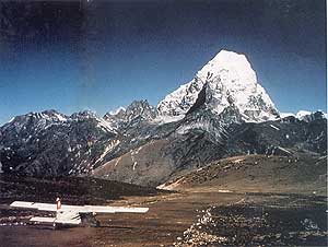
4. Ama Dablam Base Camp airport
Ama Dablam, a beautiful mountain located almost south of Mount Everest and Lhotse in Khumbu region is one of the most recognized mountains in the area. Its name literally translates to Mother and her Necklace. What many people, however, do not know is that it’s Base Camp at 4,600 meters was once used as an Airport. It was one of the highest airstrips until development in India and Tibet resulted in higher airports. Constructed hastily under the supervision of Sir Edmund Hillary and Kathmandu-based pilot, Captain Schrieber, the airport was used primarily to transport Tibetan Refugees flocking into Nepal following the political events in Tibet in 1959 via the three passes: Nangpa La, Lho La and Nup La. It was said that the airstrip cost $900 mostly and was up and ready in no time. However, the Nepal government only found out about the airstrip only after 6 months of operation.
On April 5th, 1960, a Civil Aviation officer who went as inspector landed at the Mingbo Airstrip and immediately declared it ‘closed’. However, due to lack of acclimatization and upon learning that the trip back would take over 17 days, he declared the airstrip to open again, for one last time so he could make his way back. Due to controversy and international sensitivity, unofficial stories claimed the airport was for an Ama Dablam expedition.
5. Did Edmund Hillary climb Mount Everest?
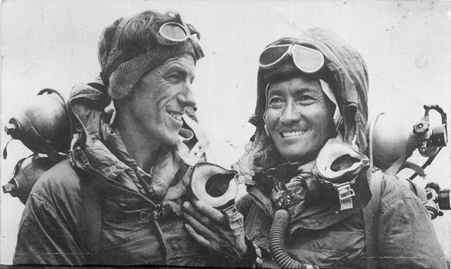
While he most certainly did, there is no direct photographic evidence that Sir Edmund Hillary was at the summit of Mt Everest. All the iconic photographs of the expedition from the top have Tenzing Norgay Sherpa in different postures. Was Hillary actually there? Most definitely, but given that Tenzing didn’t know how to operate a camera we have no evidence of Hillary’s ascent. Talk about reaching the top of the world knowing your face would never be there!! Irony at the top of the world.