Map helps you to map the place which you may not map without a map. Is it confusing? But a map surely is not made to confuse you but rather to clear your confusion, but this implements only to those who know how to read a map, otherwise you will be tangled in the line and landmarks of the map.
Maps are not seen as an important tool by a growing number of travellers, this is especially true for many trekking regions of Nepal. Development is brought about enough trail improvement, hundred of lodges and thousands of guides, along with other modern amenities as a collective have made maps obsolete for a lot of mainstream travel activities. However, as soon as one gets just a short distance out of such popular trails, one better have a map, and a good one.
It was was just maps and books that would tell you what's in a place beside terrain features but times have changed and it's the internet that has the audience telling people what to see and where to go. Such researches are done before travel begins but once you enter a so-called ‘remote area’. Aesthetically too, maps are more important than the ticket to the place as you check the map before going to a place, and to build a certain image of the place and decide on what you can expect there. You hold it while being there to be guided and after the journey back home you check the map, admire that you have been to such a beautiful place and remote place. But do you do same with the ticket?
To make your visit to Nepal easy and informative, we have listed some of the commonly available and best maps for Nepal.
1) TAAN map:
It is a map by Trekking Agencies’ Association of Nepal (TAAN) which the most detailed among all the maps in consideration here. is comparatively in very detail. It is more suitable for adventurers and explorers who don’t give a second thought before hitting the road when they find a new trail. You will find names and locations of even the smallest of villages, many smaller peaks, and almost all the attractions like temples & monasteries of the area, main trails along with even shepherd trails some of which are centuries old. Contour lines are dense and legends could possibly be more than needed, but the layout and designs are easy on the eyes. A major drawback is availability, as this is a map produced by an association of travel companies whose core activity in not selling maps and hence, other maps are more commonly available at shops. One place guaranteed to have the maps is the office building of TAAN located just beside national Police headquarters. There is an upside of being a non-commercial map as maps are made even for areas that may not attract much visitor and hence deem the map commercially unviable. However, it's only those who know how to read maps who can fully optimise the maps. This is the best option for people who would love to explore new places, new trails, find new peaks and routes to approach and climb them. If you are in adventure and discovery travel mode when in Nepal, look no further. For a moderate adventurer, such maps can and will present you with alternative routes, short trips; even if you are trekking main tourist trails, it can lead you to many beautiful places in between tourist overnight stops.
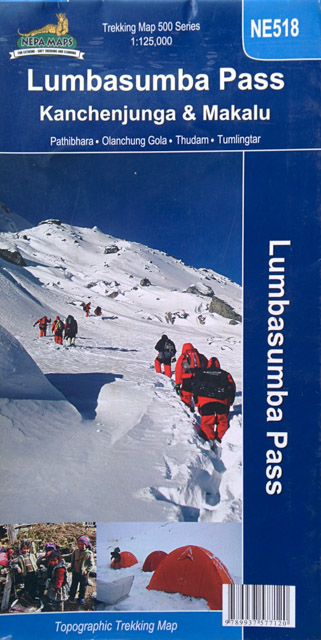
2) Nepa maps:
Nepa Maps is also one of the best in trekking maps available. It is easy to understand with supportive legends and other indexes that will guide us on reading a map. While it's not as detailed as TAAN maps but many would say that it's good enough to be used for remote areas too. Like TAAN maps, many smaller peaks are featured but coverage of small settlements and smaller attraction like temples and monasteries are not nearly as extensive. Terrain and landscape features are in fact very well presented and also has high level of accuracy; in these areas the TAAN maps outperform Nepa Maps but the latter is much more commonly available even though they command higher price; but worth the extra amount. Like TAAN maps, it too makes a point of covering remote areas that may not make economic sense. This map is good enough even for hardcore adventurers, or people looking to discover new places or find new trails.
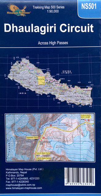
3) Himalayan map:
Produced by Himalaya Kartographisches Institut, Himalayan Map series is Nepa Map’s sibling as both are from the same organisation. While it is not as commonly found as Nepa maps, there are still fairly common. Perhaps it's planned to be phased out as Nepa map is clearly much better as a map and also commands higher sales. Contour lines are at least 3 times as sparse as TAAN maps and nearly twice as much as Nepa’s. Small settlements, especially outside the immediate vicinity of the main trail are poorly covered and is less accurate than maps described above. Topographic features are not as well depicted and are also less accurate. This is clearly not the one for adventurers trying to make new discoveries or venture into new areas. Major trails are covered, but little attention is paid to smaller or alternative trails unlike the two above. This will be useful to travellers who plan to stick to main trails but would like to have a general idea of where they are. It is easy to understand but not as pleasing to the eye as Nepa. You will get a good share of information in good price. But you will find this map for only popular trekking routes or popular areas.
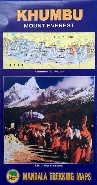
4) Mandala Trekking Maps:
A very basic map with not a long list in the legends section. You won't have to worry about information overload, comparatively it has little information. Lost of settlements including the ones at main tourists are ignored and you and forget about smaller attraction like small temples, monasteries, etc. Neither are the contour line dense nor the topographic are in enough details to be used as the guideline for exploration or even plannings. The series is also limited to popular trekking areas only. Finding small peaks, trails or even many settlements is out of the question. This is a pure ‘Tourist Map’ and will only be helpful in popular trails and to give you a general idea of the surroundings of the places you will visit. The map is the most available one and does not feature lesser trekked trails. It is much cheaper than others. Adventure travel operators are probably the biggest buyers of this map as many companies provide free maps to their clients as a part of their packages.